1 month, 3 weeks ago
UFAZ Hosted a Research Seminar on Geodesy and Tectonic Movements
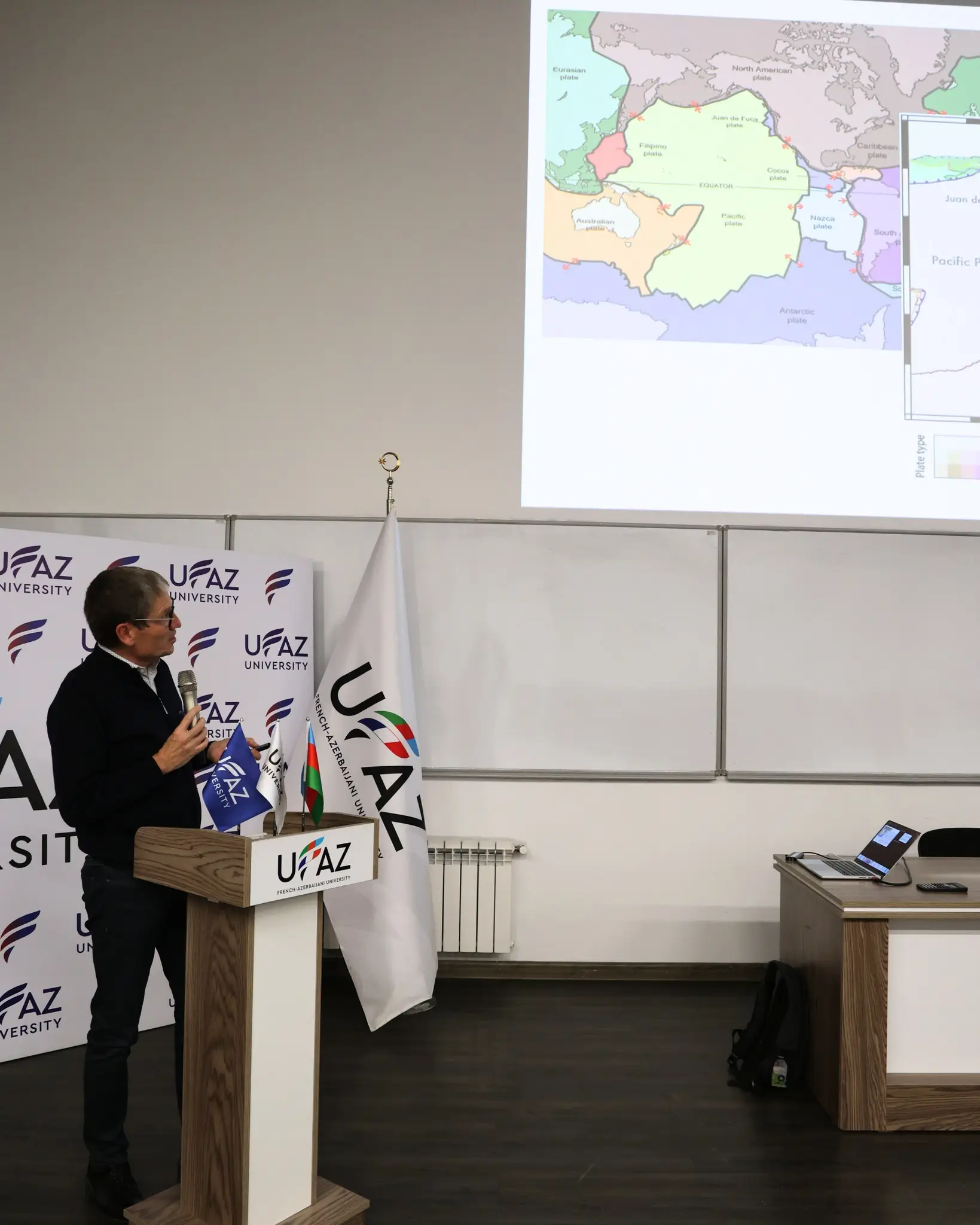
On December 12, the French-Azerbaijani University (UFAZ) hosted a research seminar titled “Strain Rates along the Alpine-Himalayan Belt from a Comprehensive GNSS Velocity Field,” delivered by Professor Frédéric Masson. The seminar brought together students, researchers, and academics with interests in geophysics, geology, and natural disaster modeling.
Professor Masson is affiliated with the School and Observatory of Earth Sciences (EOST) and the Strasbourg Institute of Earth and Environment (ITES) at the University of Strasbourg (UNISTRA), as well as the French National Centre for Scientific Research (CNRS). His research focuses on continental collision zones, rift systems, intraplate deformation, and the application of GNSS data for atmospheric monitoring and subsurface structure observation.
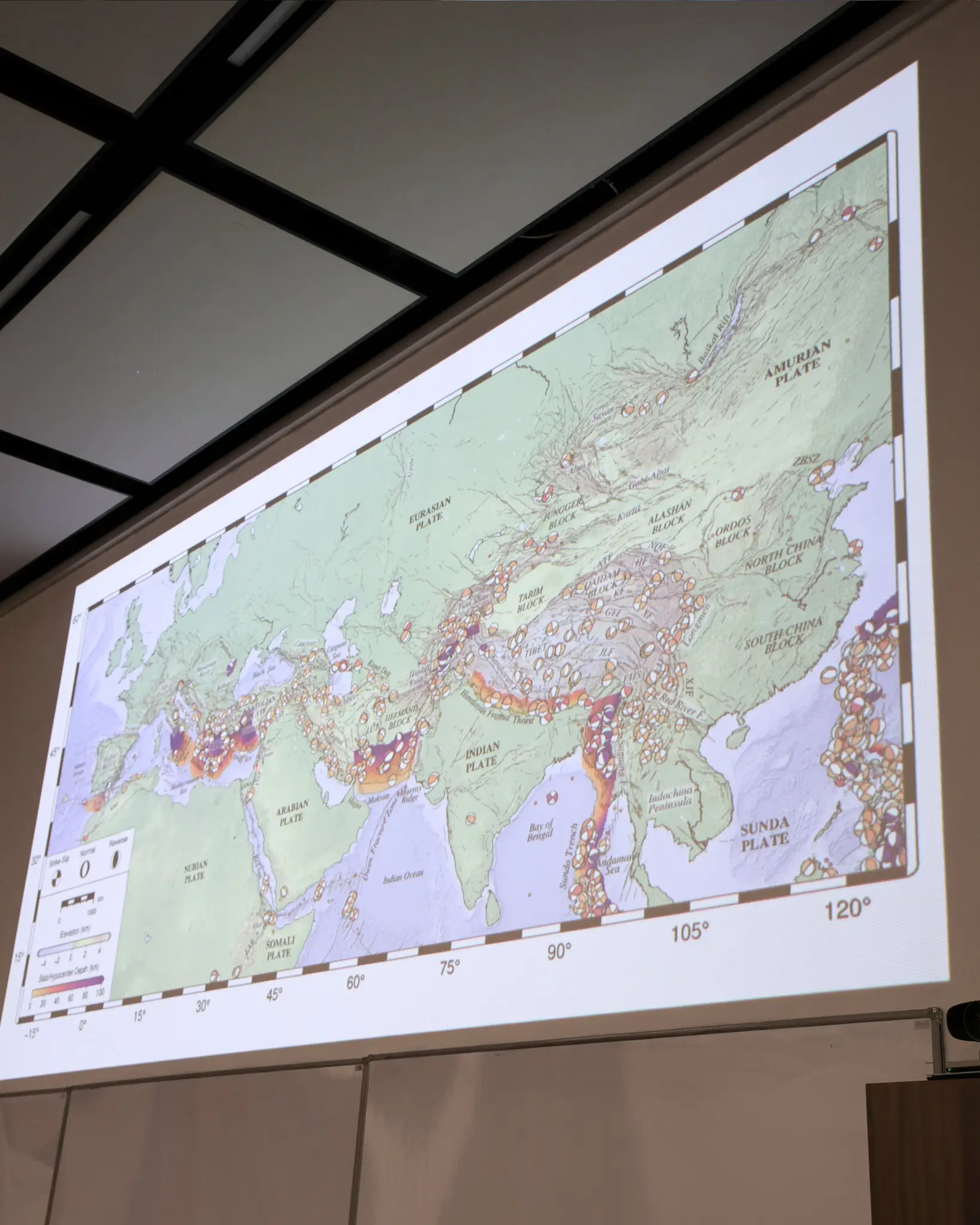
During the seminar, Professor Masson presented a comprehensive study of the Alpine-Himalayan belt, one of the most tectonically active and complex regions on Earth. The research integrates 42 published GNSS velocity fields into a single, internally consistent dataset covering the entire belt from Iberia to Southeast Asia, comprising more than 11,000 horizontal and 3,900 vertical velocity measurements. Using this unified GNSS dataset, surface strain rates and associated uncertainties were estimated for key regions, including the eastern Mediterranean and the India–Asia collision zone.
The findings reveal a strong large-scale consistency between geodetic and seismic strain rate tensors across the belt. Moreover, the study confirms previously observed alignments between principal strain rate directions and seismic anisotropy, particularly in regions such as the Aegean, North Anatolia, Tibet, Tian Shan, Altai, Sayan, and Baikal. These results highlight the close relationship between mantle flow and lithospheric deformation and emphasize the need for further research to better understand the geodynamic processes governing seismic hazards in these regions.
The seminar provided valuable insights into large-scale tectonic deformation and demonstrated the importance of integrated geodetic data in advancing earthquake and hazard research.